The Source to Cricklade
Saturday 8 April 2017

Our first day on the Thames Path began with a train journey from Oxford to the village of Kemble in Gloucestershire, which is the nearest railway station to the Source, having had to change at Didcot Parkway and Swindon along the way. We had hoped to take a taxi from Kemble station to the point on the road nearest to the start of the path. This was partly to save time and energy but also to avoid the A433 which is certainly not ideal for walkers. Unfortunately, we were let down by the taxi company who failed to meet us at the agreed time and we were left with a journey on foot of about a mile and three quarters to the official starting point. The actual route for the day, a little over twelve and a quarter miles, is shown on the map in red. For the most part of course the route follows the river, but the blue sections show the course of the river where the path is forced away from it, usually by issues relating to rights of way.
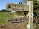
The start of the Thames Path shows very little sign of a river, at least at the time of year when we were there. In winter many of the fields around the Source are liable to be flooded, but in early April they were completely dry and we were reliant on the marker stone and signpost to know we were in the right place. Although disputed by some, this point is recognised as the official Source of the Thames and a large stone has been placed at the spot. The plaque on the stone is a little hard to read, but states:
The Conservators of the River Thames
1857 - 1974
This stone was placed here to mark the
Source of the River Thames
After the obligatory photos, both with the stone and the wooden signpost which informs you of the somewhat daunting task ahead ("Thames Barrier London; 184 miles 294 km"), we set out on our journey a little later than I had hoped and just as a sunny spring morning was really beginning to warm up. Because of the short walk from the A433 which is needed to get to the starting point, the first few minutes are simply retracing those steps to get back to the road and cross over. Having done that, the journey along the Thames could really begin as it is not long until the first sight of running water.
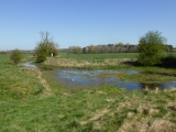
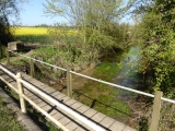
Just a couple of fields further along, our first view of the Thames was a shallow, narrow stream emerging from between the trees. It was already proving popular with the local wildlife, as a group of some twelve ducklings swam past with their mother. Here the path crosses another A-road, the A429, as it skirts just past Kemble and heads towards the first village actually on the route, Ewen. After following the crystal clear stream through the trees and alongside the bright yellow fields of rapeseed in flower, we came to the road which links Kemble and Ewen and took our first rest stop on a bench located right on the very edge of the village.
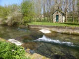
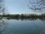
Heading through Ewen, we picked up the river on a short stretch where walls along the banks guide the Thames around the housing, as well as taking the river over its first weir, before it re-emerges into open countryside. We soon came to what would become a familiar sight all the way to London, as we passed the first of a great many swans which make the river their home. Being spring, the fields which took us past several farmhouses were filled with young lambs and their mothers, many of them sensibly finding shade along the hedges on what was becoming an increasingly warm day. A couple of miles on from Ewen, the still narrow Thames is suddenly replaced by considerably more water as you reach first Neigh Bridge Country Park and then the Cotswold Water Park. Many man-made lakes fill the countryside here and it was near to one of them that we made our lunch stop, the ground still wet with dew despite the midday sun.
By-passing the village of Somerford Keynes, the Thames Path heads through yet more lakes and it is on a straight section of the river between the lakes that you change counties for the first time, leaving Gloucestershire and entering Wiltshire. The shade of this tree-lined section was very welcome and eventually brought us to the village of Ashton Keynes, where for the first time the path is forced to divert from the river for a significant period. We decided to make another rest stop in Ashton Keynes, taking a break on the edge of the village's sports field where Ashton Keynes FC were in action, taking on Poulton in the First Division of the Cirencester and District League. Not stopping to watch the rest of the game (which, incidentally, finished 1-1), we headed back between the lakes of the Cotswold Water Park for the final stretch of the journey to Cricklade.
On the journey away from Ashton Keynes, we reached perhaps the most difficult part of the opening day as what had clearly been a very uneven path had been levelled out using loose gravel, which did not make it terribly comfortable to walk on. Here, the river is absent for a couple of miles as you make your way between the lakes, as well as heading around one are which is fenced off and surrounded by signs warning of the dangers of quicksand. Passing by several farmhouses, the Thames Path briefly re-enters Gloucestershire as it leaves the Cotswold Water Park behind, before moving back into Wiltshire as Cricklade, the first town on the river, approaches.
As we began to tire at the end of a long day which had seen us catch the bus to Oxford station a little after 7am, we picked up the river again as it passes under what used to be the railway line between Cricklade and nearby South Cerney. Here, the Thames is starting to become noticeably wider and deeper than it was when it was weaving through the lakes of the Water Park. The approach to Cricklade takes you through more farmland and it was just after passing through a field of horses that we crossed the river and left it behind for Day One, heading for the town. After a brief and unintended detour onto a housing estate, we found the right route into the centre of Cricklade and our first night's accommodation at The Old Bear pub.


