St Paul's to Thames Barrier
Saturday 22 April 2017
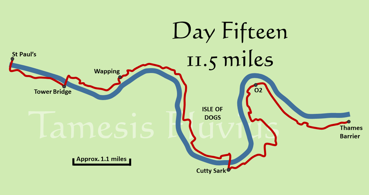
Two weeks on from leaving Oxford for the first time, we had arrived at the final stage of our journey to the Thames Barrier, with just a little over eleven more miles to the end of the path. It was another day when we had to decide between the northern and southern banks and stuck with the northern side for much of the route, largely in order to be able to walk through the foot tunnel at Greenwich. Sadly it was a day when we knew we would have to divert from the normal path for some time, as building work in Greenwich meant that a section of the route was closed. It was also a day when we encountered something which had been very rare during our trip, namely rain. Up to this point we had only had a few spots floating in the air between Henley and Marlow, which barely counted at all, but there was actually a proper rain shower on the final day although happily it was short lived.
The final leg of our journey began outside St Paul's Cathedral as the clock struck 7.00 am, the early start having the same effect as our morning visit to Windsor Castle in allowing us to take some photos without hundreds of tourists around. The same was true as we crossed the Millennium Footbridge, with hardly anybody else around as we started our journey on the southern bank in Southwark. Having passed by Shakespeare's Globe we diverted from the river slightly to go around the full size replica of Sir Francis Drake's ship the Golden Hind, before heading under London Bridge and across the musical paving slabs which play the familiar tune of 'London Bridge is Falling Down'. Just as we prepared to return to the river bank however, we were faced with a very unexpected detour.
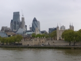
Almost immediately after London Bridge we could see police tape up ahead and officers just inside it, one of whom directed us to go up some steps to road level and around the barrier. The cordon was blocking our intended path to the river so we had to continue along the road and take another route back to the Thames, although we did retrace the path along the bank a little in order to cover as much of the path as we could! This stretch of the river is full of famous landmarks, with the warship HMS Belfast out on the Thames, the Tower of London on the opposite bank and the unmistakable shape of Tower Bridge looming ahead of us. Passing City Hall on our right, we climbed the steps up onto Tower Bridge and crossed over the Thames for the final time.
Whichever side of the river you choose between Tower Bridge and Greenwich, there are inevitably some stretches out of sight of the river as the path detours through the roads of East London. On the northern bank, we headed away from Tower Bridge and on into Wapping. Through this section there are several places where the path makes short returns to the river as it journeys down Wapping High Street where many more barriers for the London Marathon were being put out. One of the riverside sections was somewhat confusingly signed as the right of way has clearly changed and one Thames Path sign was covered over but remained in place. Heading into King Edward VII Memorial Park, the grey clouds did what they had been threatening and provided us with some drizzle, although not enough to make us stop and put on waterproofs for the first time.
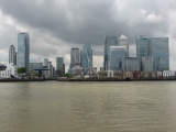
Leaving the park, we now had the skyscrapers of Canary Wharf ahead of us and began to make the long turn round to the right and onto the Isle of Dogs - which is, of course, not an island at all but rather a large peninsula. The path stays beside the river for the first half of the journey along the western side of the Isle of Dogs, past yet more modern residential developments and an array of building sites, before diverting briefly onto the main road through Millwall and past yet more marathon barriers waiting for the next day. When we returned to the river we could see the famous Cutty Sark ship and the Old Royal Naval College across the river in Greenwich, deciding to stop for lunch in Island Gardens before heading underground for our final river crossing.
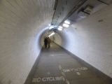
As we were eating, the light drizzle began to turn into proper rain for the first time on our whole trip, so we hurriedly finished lunch and headed down the steps into the Greenwich Foot Tunnel. When we emerged on the southern bank, we could see that there had been a heavy rain shower but that the skies were already beginning to clear and the rest of the day turned out to be bright and sunny, meaning that we had managed to almost completely avoid the only proper rain of the fortnight by being underground! Pausing to take some photos around Cutty Sark, which was also being surrounded by barriers for the marathon, we soon headed off again past the Naval College and towards the dome of the O2 which we could already see up ahead.
Before much longer, we reached the sign that we knew was coming, telling us that the path ahead was closed and that we should follow the diversion through the streets of Greenwich. That we duly did, as although it seemed as though the path might have been open for more of its usual route we did not want to be confronted by a sudden dead end. When we finally came back to the river just before the entrance to the Blackwall Tunnel, we were confronted by another view of the skyscrapers on the Isle of Dogs and a much closer view of the O2. Passing by a signpost on the line of zero longitude which told us how far it was around the world and back to that point, we turned around the northern tip of the Greenwich Peninsula and before long, got our first glimpse of the finishing line.
The Thames Barrier first comes into view almost immediately after passing under the cable cars of the Emirates Air Line and makes you think that you are very nearly at the end of the path, but there is actually still about a mile and half to go at this point. With the river noticeably wider than it had been even on the other side of the O2 and now increasingly lined by industry rather than residential buildings, the Barrier inches closer and after a brief section along the road behind warehouses, it finally looms large. On arriving alongside it, there is a short tunnel to walk through with a wall display showing the locations of all the places along the river. We emerged from the tunnel to reach the end of the path at last, the point where the National Trail ends and the unofficial extension, which we were not going to do, takes over.
Amid relief and happiness at having completed our journey, we stopped to take some photos of the Barrier and of the end of the path, but the other overwhelming feeling was one of tiredness so we did not want to stay for too long. With an eye on the time and a thought to our schedule of trains from Charlton across London and back to Oxford, we headed away from the path for the final time. A short additional walk brought us to Charlton station, from where we travelled to Cannon Street and then by underground to Marylebone, there catching the final train back to Oxford and ultimately taking a very well earned rest.


