Abingdon to Wallingford
Thursday 13 April 2017
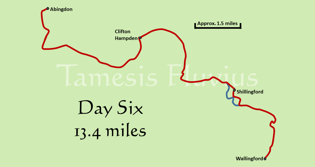
After the shorter fifth day, the sixth provided another long stage, not least because of the additional walk required to get back to the bridge in Abingdon and start the next section of the route. The day was at least made a little easier by the fact that a couple of new cuts shortened the route a little, although we also had the dubious pleasure of regular less-than-scenic views over towards the power station at Didcot. As with the previous section, the river here formed the boundary between Oxfordshire and Berkshire until the local government reforms of the 1970s, but now lies entirely in Oxfordshire. By this stage of the river settlements are becoming much more frequent along both banks, although most are still small villages.
After an excellent breakfast provided by our Airbnb host, the day began with an early morning stroll back up through Abingdon. Having stopped off to pick up some sandwiches for lunch, we rejoined the Thames Path by the bridge where we had left off the previous evening and passed by Abingdon again on the opposite bank, soon getting a clear view of the entrance to the Marina where our accommodation had been. We soon reached the sharp left hand turn at the start of the first of the day's 'shortcuts', the channel of the Culham Cut. Here, the path passes just to the south of the village of Culham, eventually rejoining the original course of the Thames just after the lock.
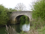
After crossing the road just outside Culham itself, we were greeted with more views of the power station in the distance before coming to a railway bridge, just to the south of the one where we had stopped for lunch the previous day. Here, the main line from Oxford to Didcot leaves behind the large meander in the Thames which passes by Abingdon. Very soon the river splits again for the Clifton Cut, another short cut where the original channel passes by the village of Long Wittenham but the Thames Path heads directly for Clifton Hampden. Very soon after Clifton Lock, the red brick structure of Clifton Hampden Bridge came into view and having cross to the southern bank there, we soon stopped for a rest on the edge of one of the fields alongside Northfield Farm.
The next stage of the path forms a large bend around to the right when heading downstream and there is a very clear difference between the two banks. Looking across the river we were able to see the impressive grounds and boat houses of a number of very large private residences in the village of Burcot, while on our side of the river there was still nothing but fields. Eventually the houses on the opposite bank came to an end and we could see another village, Dorchester-on-Thames, in the distance. Reaching Days Lock, we crossed the weir and the lock itself to return to the northern bank and soon came to the point where the similarly named River Thame joins the Thames.
This confluence marks the point above which the alternative name 'Isis' came to be used for the Thames, the ancient name of 'Tamesis' having wrongly been thought to be derived from 'Thame' and 'Isis'. We chose a spot near to where the two rivers meet to take our lunch break, after which we continued onwards towards the next village on the river, Shillingford. This was the point where we faced the day's only significant section of road walking, the path turning away from the river just before the village and heading into Shillingford on the main A4074 road towards Wallingford. After one brief glimpse of the river, the path heads away again through a narrow alley before finally rejoining the Thames on the other side of the village.
The final part of Day Six began with a long, straight section of walking along a tree-lined path, with little in the way of scenery except a large caravan park on the opposite bank. As we headed down the river, the number of large and impressive boats making their way up and down was noticeably increasing and we soon came to one of the places where many of them were based, Benson Marina. With it being the Easter holidays, the area around the Waterfront Cafe was packed with visitors and we chose to pass by and stop for a rest on a bench just beyond the marina and cafe complex.
After a very brief stretch away from the river on the edge of Benson, we reached the weir at Benson Lock which provided us with our final river crossing of the day. From there, the day ended with a another largely straight stretch of the river towards our overnight destination of Wallingford. Here we encountered a dog fresh from a swim in the river and clearly on the lookout for someone to shake water over, as it ran past us in one direction before returning and deciding to dry itself right alongside us. Having passed near to the remains of Wallingford Castle, we arrived in the town and headed to our accommodation, a hastily arranged Airbnb host in an impressive Victorian house, which replaced our original camping plans.


